File:Taiwan Regions Map.png
Size of this preview: 425 × 599 pixels. Other resolutions: 170 × 240 pixels | 1,816 × 2,559 pixels.
Original file (1,816 × 2,559 pixels, file size: 1,002 KB, MIME type: image/png)

|
This locator map image could be re-created using vector graphics as an SVG file. This has several advantages; see Commons:Media for cleanup for more information. If an SVG form of this image is available, please upload it and afterwards replace this template with
{{vector version available|new image name}}.It is recommended to name the SVG file “Taiwan Regions Map.svg”—then the template Vector version available (or Vva) does not need the new image name parameter. |

|
This file was moved to Wikimedia Commons from wts.oldwikivoyage using a bot script. All source information is still present. It requires review. Additionally, there may be errors in any or all of the information fields; information on this file should not be considered reliable and the file should not be used until it has been reviewed and any needed corrections have been made. Once the review has been completed, this template should be removed. For details about this file, see below. Check now! |
Summary
| Description |
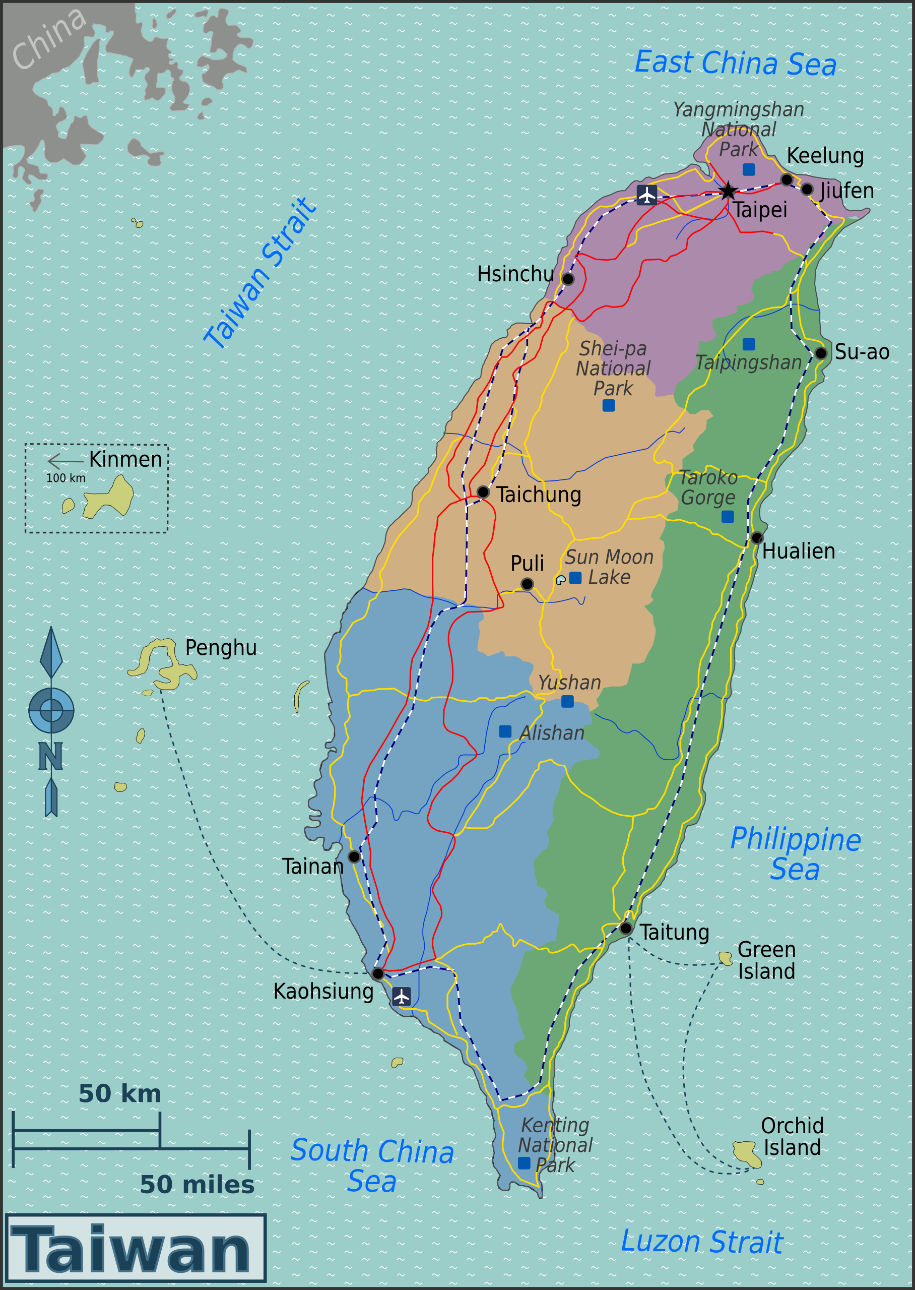
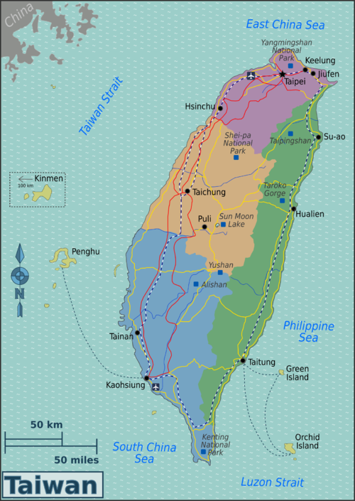
English: Map of Taiwan with regions colour coded. PNG, Taiwan
|
| Date | |
| Source | :Image:Taiwan_Regions_Map.svg |
| Author | User:(WT-shared) Burmesedays, Perry-Castañeda Library Map Collection - Taiwan Maps, OpenStreetMap |
| Other versions | Chinese |
Licensing
This file is licensed under the Creative Commons Attribution 3.0 Unported license.
- You are free:
- to share – to copy, distribute and transmit the work
- to remix – to adapt the work
- Under the following conditions:
- attribution – You must give appropriate credit, provide a link to the license, and indicate if changes were made. You may do so in any reasonable manner, but not in any way that suggests the licensor endorses you or your use.
Original upload log
| This file was imported from Wikivoyage WTS. |
The original description page was here. All following user names refer to wts.wikivoyage-old.
- 2009-11-20 15:13 (WT-shared) Burmesedays[dead link] 2140×3008 (1166533 bytes) {{Imagecredit|credit=[[User:Burmesedays]], [http://lib.utexas.edu/maps/taiwan.html Perry-Castañeda Library Map Collection - Taiwan Maps], [ (Import from wikitravel.org/shared)
- 2009-11-27 14:44 (WT-shared) Burmesedays[dead link] 2140×3008 (1236966 bytes) added main railway lines (Import from wikitravel.org/shared)
- 2010-01-07 12:54 (WT-shared) Burmesedays[dead link] 1823×2569 (954341 bytes) fixed scale (Import from wikitravel.org/shared)
- 2010-04-03 04:48 (WT-shared) Burmesedays[dead link] 1823×2569 (1033283 bytes) tidied up a slightly embarrassing old map (Import from wikitravel.org/shared)
- 2010-04-03 04:53 (WT-shared) Burmesedays[dead link] 1823×2569 (1030463 bytes) and some more (Import from wikitravel.org/shared)
- 2010-11-09 20:17 (WT-shared) Globe-trotter[dead link] 1816×2559 (1026757 bytes) fixed color for central region (Import from wikitravel.org/shared)
- 2011-10-22 23:51 (WT-shared) Joelf[dead link] 1816×2559 (1026387 bytes) Kaoshiung -> Kaohsiung (Import from wikitravel.org/shared)
File history
Click on a date/time to view the file as it appeared at that time.
| Date/Time | Thumbnail | Dimensions | User | Comment | |
|---|---|---|---|---|---|
| current | 01:25, 19 December 2012 | | 1,816 × 2,559 (1,002 KB) | OgreBot | (BOT): Reverting to most recent version before archival |
File usage
The following page links to this file:
