File:Pont de l'amitié Chine-Niger - Niamey from the Sky.jpg

Size of this preview: 800 × 450 pixels. Other resolutions: 320 × 180 pixels | 4,608 × 2,592 pixels.
Original file (4,608 × 2,592 pixels, file size: 2.97 MB, MIME type: image/jpeg)
Summary
| Description |
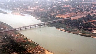
English: Aeria view of the China-Niger Friendship Bridge, most often called “Chinese Bridge”, previously “second bridge”, opened on Friday, March 18th, 2011 and located in Niamey, Niger.
Français : Vue aérienne du pont de l'amitié Chine-Niger, plus souvent appelé le « pont des chinois », précédemment « deuxième pont », inauguré le vendredi 18 mars 2011 et situé à Niamey, Niger. |
| Date | |
| Source | Own work / Pont de l'amitié Chine-Niger - Niamey from the sky on Flickr |
| Author | Jean Rebiffé |
| Camera location | | View this and other nearby images on: OpenStreetMap |
|---|
| Camera Model | Sony Cyber-shot DSC-HX7V |
|---|---|
| Mode | Automatic |
| Shutter speed | 1/800 |
| Aperture | f/4.5 |
| Exposure compensation | 0 EV |
| Film speed (ISO) | 125 |
| Focal length | 12.0 mm |
Licensing
I, the copyright holder of this work, hereby publish it under the following licenses:
This file is licensed under the Creative Commons Attribution 3.0 Unported, 2.5 Generic, 2.0 Generic and 1.0 Generic license.
- You are free:
- to share – to copy, distribute and transmit the work
- to remix – to adapt the work
- Under the following conditions:
- attribution – You must give appropriate credit, provide a link to the license, and indicate if changes were made. You may do so in any reasonable manner, but not in any way that suggests the licensor endorses you or your use.

|
Permission is granted to copy, distribute and/or modify this document under the terms of the GNU Free Documentation License, Version 1.2 or any later version published by the Free Software Foundation; with no Invariant Sections, no Front-Cover Texts, and no Back-Cover Texts. A copy of the license is included in the section entitled GNU Free Documentation License. |
You may select the license of your choice.
File history
Click on a date/time to view the file as it appeared at that time.
| Date/Time | Thumbnail | Dimensions | User | Comment | |
|---|---|---|---|---|---|
| current | 14:52, 21 October 2012 | | 4,608 × 2,592 (2.97 MB) | Jeanot | User created page with UploadWizard |
File usage
The following page links to this file:
