File:Map of Connecticut Regions.png

Size of this preview: 800 × 534 pixels. Other resolutions: 320 × 214 pixels | 2,534 × 1,692 pixels.
Original file (2,534 × 1,692 pixels, file size: 321 KB, MIME type: image/png)
Summary
| Description |
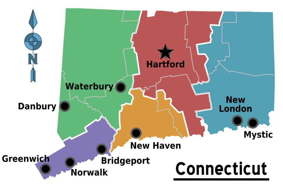
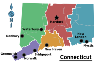
English: Regions of Connecticut with Cities. Map showing Connecticut's travel regions, cities, and major destinations.
|
| Date | |
| Source | :commons:File:CTMap county boundaries.svg (public domain) |
| Author | User:(WT-shared) LtPowers |
| Other versions |
SVG version |
Licensing
This file is licensed under the Creative Commons Attribution-Share Alike 4.0 International, 3.0 Unported, 2.5 Generic, 2.0 Generic and 1.0 Generic license.
- You are free:
- to share – to copy, distribute and transmit the work
- to remix – to adapt the work
- Under the following conditions:
- attribution – You must give appropriate credit, provide a link to the license, and indicate if changes were made. You may do so in any reasonable manner, but not in any way that suggests the licensor endorses you or your use.
- share alike – If you remix, transform, or build upon the material, you must distribute your contributions under the same or compatible license as the original.
Original upload log
| This file was imported from Wikivoyage WTS. |
The original description page was here. All following user names refer to wts.wikivoyage-old.
- 2009-03-08 03:18 (WT-shared) LtPowers[dead link] 2534×1692 (328304 bytes) == Summary == {{Imagecredit|credit=[[User:LtPowers]]|captureDate=7 March 2009|location=Connecticut|source=[[:commons:File:CTMap county bound (Import from wikitravel.org/shared)
File history
Click on a date/time to view the file as it appeared at that time.
| Date/Time | Thumbnail | Dimensions | User | Comment | |
|---|---|---|---|---|---|
| current | 10:46, 1 December 2012 | | 2,534 × 1,692 (321 KB) | MGA73bot2 | {{BotMoveToCommons|wts.oldwikivoyage|year={{subst:CURRENTYEAR}}|month={{subst:CURRENTMONTHNAME}}|day={{subst:CURRENTDAY}}}} == {{int:filedesc}} == {{Information |description=Regions of Connecticut with Cities. Map showing Connecticut's travel regions, ... |
File usage
The following page links to this file:
