File:Luzern old part of town.JPG

Size of this preview: 800 × 532 pixels. Other resolutions: 320 × 213 pixels | 3,008 × 2,000 pixels.
Original file (3,008 × 2,000 pixels, file size: 2.47 MB, MIME type: image/jpeg)
Summary
| Description |
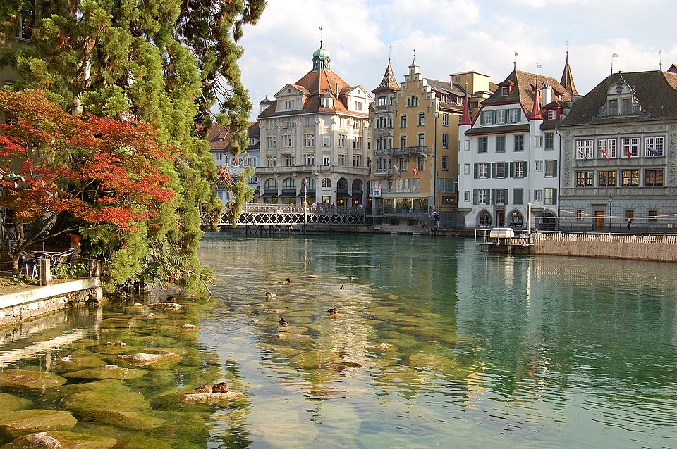
Deutsch: Der Fluss Reuss inmitten der Altstadt von Luzern/Schweiz
English: The river Reuss in the old part of Lucerne/Switzerland
Español: El río Reuss en el casco antiguo de Lucerna/Suiza
Français : Le Reuss dans la vieille ville de Lucerne, en Suisse
Português: O rio Reuss na parte antiga de Lucerne/Suiça
Camera: Nikon D50Lens: AF-S DX Zoom-Nikkor 18-55 mm 1:3,5-5,6G ED |
| Date | |
| Source | Own work |
| Author | Simon Koopmann |
| Camera location | | View this and other nearby images on: OpenStreetMap |
|---|
Assessment
|

This image was selected as picture of the day on Wikimedia Commons for 29 April 2007. It was captioned as follows:
|
Licensing
This file is licensed under the Creative Commons Attribution-Share Alike 2.5 Generic license.
- You are free:
- to share – to copy, distribute and transmit the work
- to remix – to adapt the work
- Under the following conditions:
- attribution – You must give appropriate credit, provide a link to the license, and indicate if changes were made. You may do so in any reasonable manner, but not in any way that suggests the licensor endorses you or your use.
- share alike – If you remix, transform, or build upon the material, you must distribute your contributions under the same or compatible license as the original.
File history
Click on a date/time to view the file as it appeared at that time.
| Date/Time | Thumbnail | Dimensions | User | Comment | |
|---|---|---|---|---|---|
| current | 18:37, 29 September 2006 | | 3,008 × 2,000 (2.47 MB) | Simonizer | {{Information |Description = {{de| Landschaft mit See in der Nähe des Sunnig Grat im Canton Uri/Schweiz}} {{en|Landscape with a lake in the near of the Sunnig Grat summit in the Canton of Uri/Switzerland}} |Source = own work |Date = 2006-09-16 |Author |
File usage
The following page links to this file:
