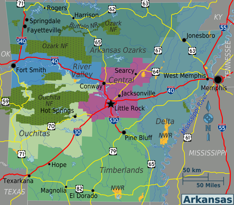
File:Arkansas regions map.png

Size of this preview: 684 × 600 pixels. Other resolutions: 274 × 240 pixels | 2,400 × 2,104 pixels.
Original file (2,400 × 2,104 pixels, file size: 1.44 MB, MIME type: image/png)
Summary
| Description | Arkansas regions map (Wikivoyage regional scheme), English version |
| Date | |
| Source | Own work based on the map from the National Atlas of the United States of America |
| Author | Peter Fitzgerald |
| Other versions | SVG source |
Licensing
This file is licensed under the Creative Commons Attribution 3.0 Unported license.
- You are free:
- to share – to copy, distribute and transmit the work
- to remix – to adapt the work
- Under the following conditions:
- attribution – You must give appropriate credit, provide a link to the license, and indicate if changes were made. You may do so in any reasonable manner, but not in any way that suggests the licensor endorses you or your use.
Original upload log
| This file was imported from Wikivoyage WTS. |
The original description page was here. All following user names refer to wts.wikivoyage-old.
- 2009-11-08 10:03 (WT-shared) Peterfitzgerald archive copy at the Wayback Machine 2400×2104 (1510017 bytes) {{Imagecredit|credit=Peter Fitzgerald|captureDate=8 November 2009|location=Arkansas|source=[[:Image:Arkansas regions map.svg]]|caption=Arkan (Import from wikitravel.org/shared)
File history
Click on a date/time to view the file as it appeared at that time.
| Date/Time | Thumbnail | Dimensions | User | Comment | |
|---|---|---|---|---|---|
| current | 21:49, 17 November 2012 | | 2,400 × 2,104 (1.44 MB) | MGA73bot2 | {{BotMoveToCommons|wts.oldwikivoyage|year={{subst:CURRENTYEAR}}|month={{subst:CURRENTMONTHNAME}}|day={{subst:CURRENTDAY}}}} == {{int:filedesc}} == {{Information |description=Arkansas regions map. English version, Arkansas * Map of: Arkansas¤ |date=8 N... |
File usage
The following page links to this file:
