File:Панорама Миколаєва.jpg

Original file(1,024 × 768 pixels, file size: 274 KB, MIME type: image/jpeg)

This file is from Wikimedia Commons and may be used by other projects. The description on its file description page there is shown below.

Description
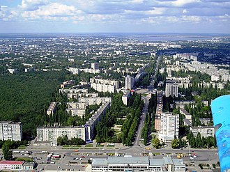
English: Railway station
Українська: Залізничний вокзал
Date Unknown date
Source Залізничний вокзал / Фотографія 2 з 5 – Wikimapia
Author zheton_
Permission
(Reusing this file)
Wikimapia logo This file is a user submission or incorporates data from the Wikimapia website, API or other current or future WikiMapia services and is hence released under the terms of the Creative Commons Attribution-ShareAlike 3.0 Unported license. See Wikimapia terms reference (p. 1.F).
w:en:Creative Commons
attribution share alike
This file is licensed under the Creative Commons Attribution-Share Alike 3.0 Unported license.
You are free:
  • to share – to copy, distribute and transmit the work
  • to remix – to adapt the work
Under the following conditions:
  • attribution – You must give appropriate credit, provide a link to the license, and indicate if changes were made. You may do so in any reasonable manner, but not in any way that suggests the licensor endorses you or your use.
  • share alike – If you remix, transform, or build upon the material, you must distribute your contributions under the same or compatible license as the original.

Ukraine Warning sign

Copyright warning: A subject in this image is protected by copyright.

This image features an architectural or artistic work, photographed from a public space in Ukraine. There is no acceptable Freedom of Panorama exception in Ukraine, which means that you cannot photograph freely for anything else than non-commercial purposes.

If a copyrighted architectural or artistic work is contained in this image and it is a substantial reproduction, this photo cannot be licensed under a free license, and will be deleted. Framing this image to focus on the copyrighted work is also a copyright violation.

Before reusing this content, ensure that you have the right to do so. You are solely responsible for ensuring that you do not infringe someone else's copyrights. See our general disclaimer for more information.

Object location46° 56′ 18.38″ N, 32° 03′ 42.68″ E Kartographer map based on OpenStreetMap.View this and other nearby images on: OpenStreetMapinfo

Captions

Add a one-line explanation of what this file represents

Items portrayed in this file

depicts

46°56'18.3847"N, 32°3'42.6787"E

image/jpeg

File history

Click on a date/time to view the file as it appeared at that time.

Date/TimeThumbnailDimensionsUserComment
current00:48, 1 February 2014Thumbnail for version as of 00:48, 1 February 20141,024 × 768 (274 KB)AHbotfile was transfered from WikiMapia

The following page links to this file:

Editing and creating content requires user account. Login, if you have an account

If you don't have an account

Create account now!

Already have an account? Login Now