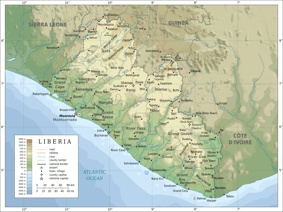
File:Topographic map of Liberia-en.svg

Size of this PNG preview of this SVG file: 799 × 600 pixels. Other resolution: 320 × 240 pixels.
Original file (SVG file, nominally 3,148 × 2,363 pixels, file size: 1.69 MB)
File history
Click on a date/time to view the file as it appeared at that time.
| Date/Time | Thumbnail | Dimensions | User | Comment | |
|---|---|---|---|---|---|
| current | 20:08, 31 July 2010 |  | 3,148 × 2,363 (1.69 MB) | Mysid | remove the false "dropoff" from land to sea in shading |
File usage
The following page links to this file:


