File:Wide-Area Map of Osaka City Subway.png
Size of this preview: 600 × 600 pixels. Other resolutions: 240 × 240 pixels | 3,508 × 3,508 pixels.
Original file (3,508 × 3,508 pixels, file size: 1.09 MB, MIME type: image/png)
Summary
| Description |
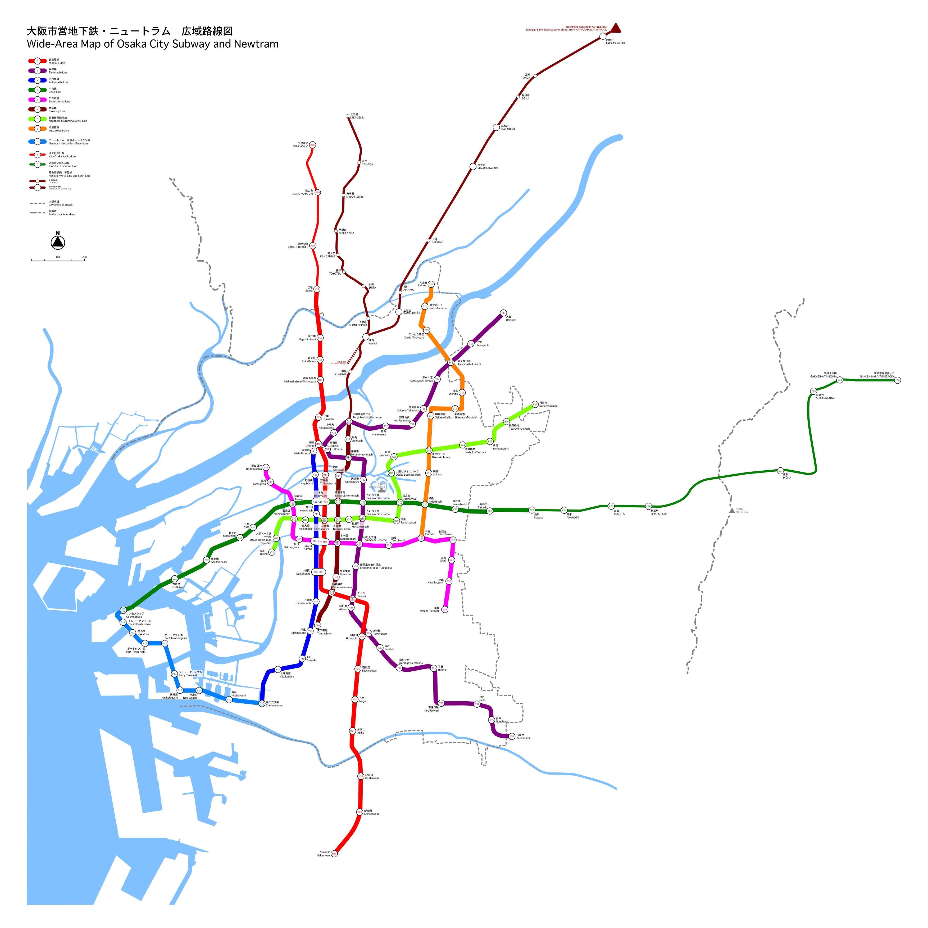
This is a wide-area map that presents Osaka city subway, Newtram and the going direction railways. (It is raster version, so it is low resolution.) ja: 大阪市営地下鉄・ニュートラム・相互乗り入れ路線を表した広域路線図(低解像度ラスタ画像) |
| Date | |
| Source | It is drawn by excl-zoo |
| Author | excl-zoo |
| Permission (Reusing this file) |
PD-self |
| Other versions | image:Wide-Area_Map_of_Osaka_City_Subway.svg |
Licensing
| I, the copyright holder of this work, release this work into the public domain. This applies worldwide. In some countries this may not be legally possible; if so: I grant anyone the right to use this work for any purpose, without any conditions, unless such conditions are required by law. |
File history
Click on a date/time to view the file as it appeared at that time.
| Date/Time | Thumbnail | Dimensions | User | Comment | |
|---|---|---|---|---|---|
| current | 13:30, 17 March 2007 | | 3,508 × 3,508 (1.09 MB) | Excl-zoo |
File usage
There are no pages that link to this file.
