File:Map-Africa-Regions.png

Size of this preview: 577 × 600 pixels. Other resolutions: 231 × 240 pixels | 991 × 1,030 pixels.
Original file (991 × 1,030 pixels, file size: 2.93 MB, MIME type: image/png)
Summary
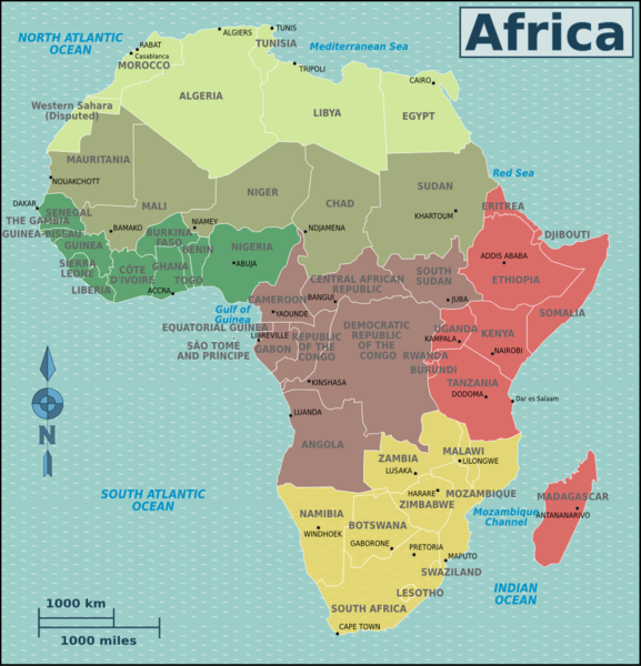
| Description | Regions of Africa for use on Wikivoyage, English version. NORTHEAST AFRICA IS SUDAN, ERITREA, DJIBOUTI AND ETHIOPIA. |
| Date | |
| Source | Own work based on the blank map of Africa |
| Author | Nick Roux and Peter Fitzgerald, amendments by Cacahuate, Burmesedays, Joelf and LtPowers |
| Other versions |
Licensing
| This work has been released into the public domain by its author, User: (WT-shared) NJR ZA at wts wikivoyage. This applies worldwide. In some countries this may not be legally possible; if so: User: (WT-shared) NJR ZA at wts wikivoyage grants anyone the right to use this work for any purpose, without any conditions, unless such conditions are required by law.
|
Original upload log
| This file was imported from Wikivoyage WTS. |
The original description page was here. All following user names refer to wts.wikivoyage-old.
- 2007-04-15 20:33 (WT-shared) NJR ZA archive copy at the Wayback Machine 1024×903 (229014 bytes) {{Imagecredit|credit=Nick Roux|captureDate=20070415|location=Africa|source=Map-Africa-Regions.svg|caption=Regions of Africa|description=Regi (Import from wikitravel.org/shared)
- 2007-04-30 07:30 (WT-shared) NJR ZA archive copy at the Wayback Machine 1452×1280 (312851 bytes) Moved Uganda to East Africa (Import from wikitravel.org/shared)
- 2007-05-13 14:28 (WT-shared) NJR ZA archive copy at the Wayback Machine 1435×1290 (306800 bytes) Correct a CC by-sa copyright infringement (Import from wikitravel.org/shared)
- 2007-06-20 18:34 (WT-shared) Peterfitzgerald archive copy at the Wayback Machine 1237×1290 (341629 bytes) minor: move city names off city bullets, change color scheme to make it a bit less high-contrast (Import from wikitravel.org/shared)
- 2007-06-20 18:58 (WT-shared) Peterfitzgerald archive copy at the Wayback Machine 1237×1290 (341970 bytes) minor: separate text "Lesotho" from "South Africa" (Import from wikitravel.org/shared)
- 2007-06-21 18:11 (WT-shared) Peterfitzgerald archive copy at the Wayback Machine 1237×1290 (342018 bytes) Minor edit with a capital M (Import from wikitravel.org/shared)
- 2008-08-11 09:21 (WT-shared) Peterfitzgerald archive copy at the Wayback Machine 1600×1695 (490211 bytes) overhaul (Import from wikitravel.org/shared)
- 2009-06-02 05:49 (WT-shared) Cacahuate[dead link] 1000×1040 (269789 bytes) region names to dark grey, ditch grey region, + title, etc (Import from wikitravel.org/shared)
- 2010-01-29 17:12 (WT-shared) Burmesedays[dead link] 2000×2078 (989478 bytes) Region assignation fixes as per talk, plus a few other small things (scale, ocean pattern, label for Djibouti). (Import from wikitravel.org/shared)
- 2010-11-22 02:53 (WT-shared) Joelf[dead link] 990×1030 (409457 bytes) Added São Tomé and Príncipe; corrected mispelling in "Gaborone". ~~~~ (Import from wikitravel.org/shared)
- 2011-07-11 00:34 (WT-shared) LtPowers[dead link] 991×1030 (370042 bytes) Add South Sudan, Juba, Addis-Ababa. Correct spelling of "Mediterranean". Fix water pattern showing through countries. (Import from wikitravel.org/shared)
- 2011-07-11 00:40 (WT-shared) LtPowers[dead link] 991×1030 (369893 bytes) Move Malawi to Southern region (Import from wikitravel.org/shared)
File history
Click on a date/time to view the file as it appeared at that time.
| Date/Time | Thumbnail | Dimensions | User | Comment | |
|---|---|---|---|---|---|
| current | 20:44, 19 July 2020 | | 991 × 1,030 (2.93 MB) | Bestoernesto | Swaziland changed its name to Eswatini 2018: "The Government of the Kingdom of Eswatini" (http://www.gov.sz/) / UN M49 Standard: (https://unstats.un.org/unsd/methodology/m49/) / ISO 3166: (https://www.iso.org/obp/ui/#iso:code:3166:SZ) / European Union: ([https://op.europa.eu/en/web/eu-vocabularies/at-concept/-/resource/authority/country/SWZ/)] |
File usage
The following page links to this file:

.png)
.png)
-%E9%9D%9E%E6%B4%B2%E5%9C%B0%E5%9B%BE.png)
.png)
.png)
.png)